Tibet, nestled in the southwest region of China. It covers a vast area of 1,202,800 square kilometers and shares borders with neighboring cities such as Xinjiang, Qinghai, Sichuan, and Yunnan. Furthermore, the borderline of Tibet is more than 4,000 kilometers long and borders many countries like Myanmar, India, Bhutan, and Nepal.
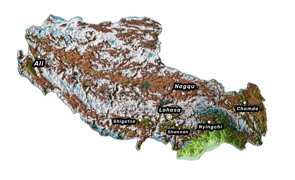
Now Tibet has jurisdiction over six cities (Lhasa, Shigatse, Shannan, Nyingchi, Chamdo, and Nagqu), one region (Ali), 74 counties. By the end of 2021, the resident population of the whole region was 3.66 million, and the Tibetan population accounted for about 90%. Besides Tibetan and Han, there were Hui, Moinba, Lhoba, Naxi, Sherpa, etc.
The mountains dividing the south and north of Tibet are the Tanggula Mountains, the south is the Southern Tibetan Valley, and the north is the Northern Tibetan Plateau. South Tibet Valley, located between the Gangdise Mountains and the Himalayas, is the main agricultural area in Tibet with flat terrain and fertile soil. North Tibet Plateau, accounting for about 2/3 of Tibet’s area, is composed of a series of round and gentle hills with many basins sandwiched between them, and it is the animal husbandry area in Tibet.
Tibet has a vast territory, complex and diverse terrain, abundant products, and various varieties of animal and plant resources. There are 65 species of wildlife under special state protection, and the standing tree stock ranks first in China. In this vast land, there are ice and snow ridges and the Gobi Desert, numerous mountains and magnificent peaks, steep and deep gullies and gorges, glaciers, bare stones, and a wide variety of exotic flowers and rare wild animals.
Tibet Tourism Map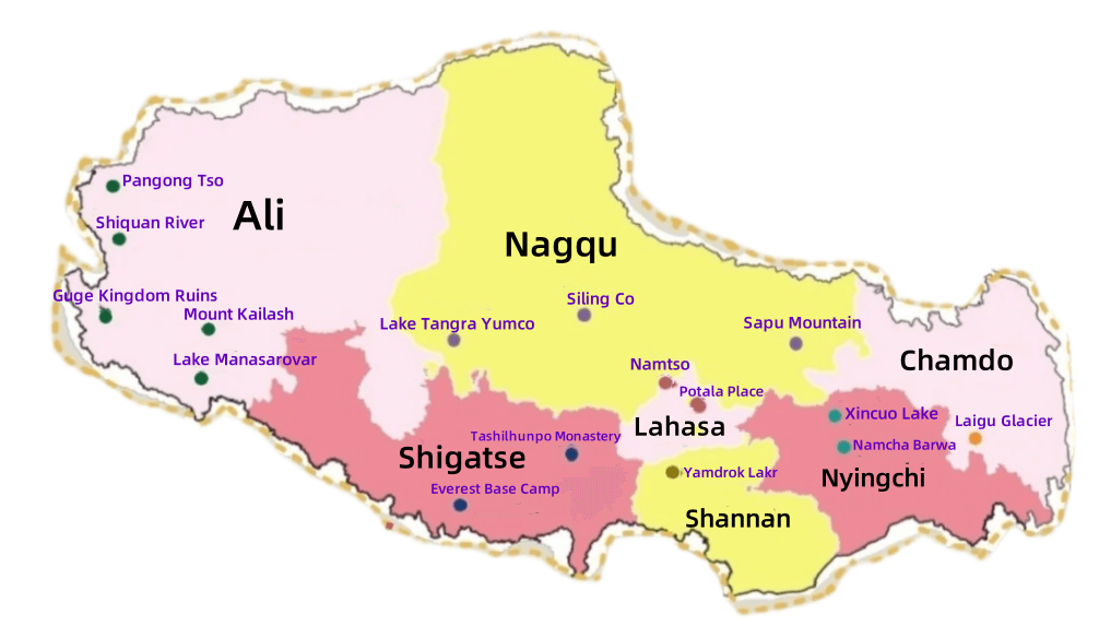
Tibet is rich in tourism resources and peculiar in its natural landscape. It consists of seven districts, and first-time tourists generally arrive in Lhasa. Therefore, the scenic spots around Lhasa and its suburbs are relatively well-developed, followed by Nyingchi and Shigatse. Shannan, Chamdo, Ali, and Nagqu have many scenic spots, but they lack better development, due to their remote locations and high altitude.
Tibet’s tourist areas are mainly classified into snow-capped mountain scenery areas dominated by the Himalayas, grassland scenery areas dominated by Qiangtang grassland in northern Tibet, natural ecological scenery areas dominated by forest canyons in southeast Tibet, and plateau lake and mountain scenery areas dominated by the sacred mountains and lakes of Ali. Lakes include plateau snow-capped mountains and lakes represented by the sacred mountains and lakes of Ali, grassland lakes represented by Namsto, and plateau forest lakes represented by Basum.
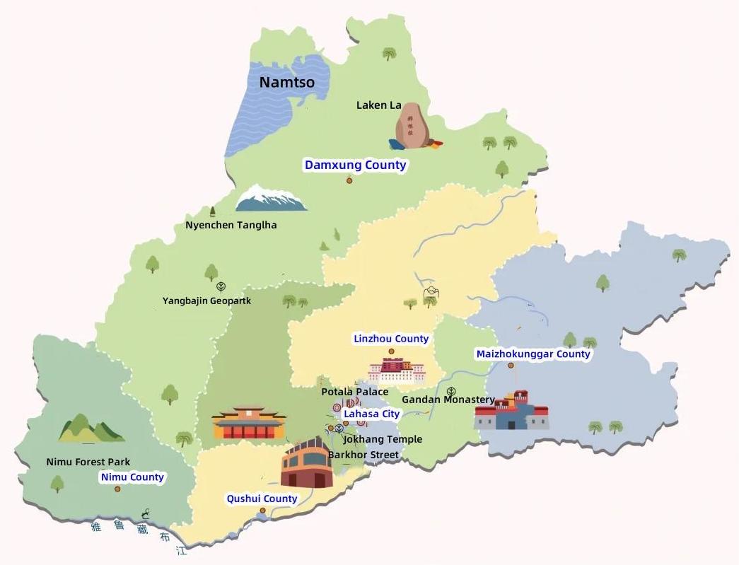
Lahasa Tourism Map
Lhasa has stunning scenery, rich history, distinctive customs, and religious significance, and is often the first destination for those who want to explore Tibet. The city is predominantly a cultural and temple landscape, where you can experience a leisurely pace of life and take your time to soak in the surroundings.
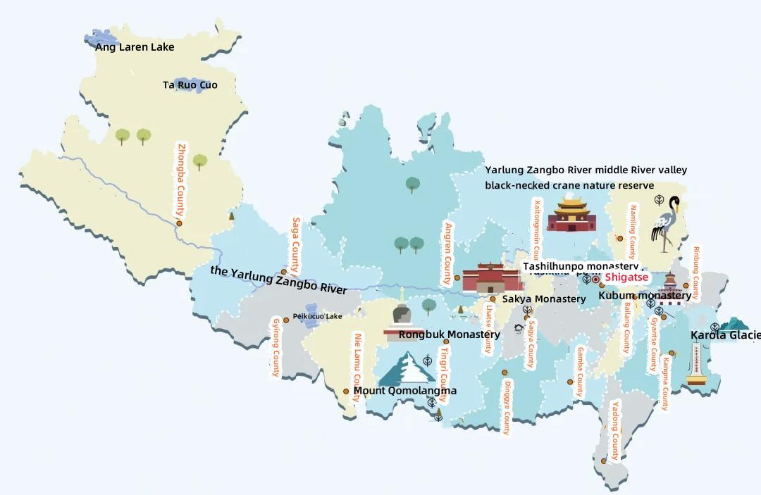
Shigatse Tourism Map
Shigatse has snow-capped mountains headed by Mount Everest, beautiful virgin forests, sacred mountains with mountains and waters, holy lakes with lakes and mountains, and grasslands with flying warblers. Shigatse also has scenic spots full of religious colors and a historical and cultural atmosphere, and its architectural style and artistic value are breathtaking.
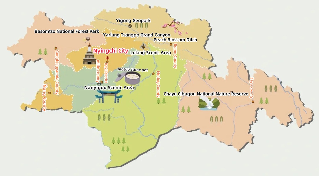
Nyingchi Tourism Map
Nyingchi is the Jiangnan of Tibet, with dense forests and magnificent landscapes. There are famous scenic spots, such as the Yarlung Zangbo River Grand Canyon and Gala Peach Blossom Village. Here you can feel the freshness of nature.
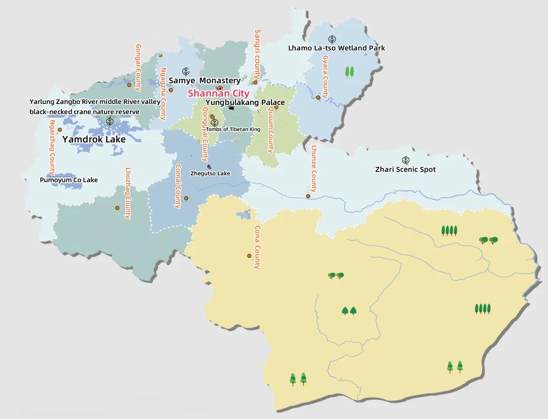
Shannan Tourism Map
Shannan is the cultural birthplace of Tibet, with numerous historical and cultural heritages. There are famous scenic spots such as Samye Temple and Yumbulakhang Place. Here you can feel the profoundness of Tibetan culture.
Nagqu Tourism Map
Nagqu is the north gate of Tibet, and it is also an area with beautiful grassland scenery. There are famous scenic spots such as Namsto and Qiangtang Grassland. Here you can feel the breadth of nature and the unique charm of Tibetan culture.

Ali Tourism Map
Ali is the roof of Tibet, with plateau scenery and magnificent landscapes. There are famous scenic spots such as Kailash Mount and Lake Mansarovar. Here you can feel the mystery of nature and the characteristics of Tibetan culture.

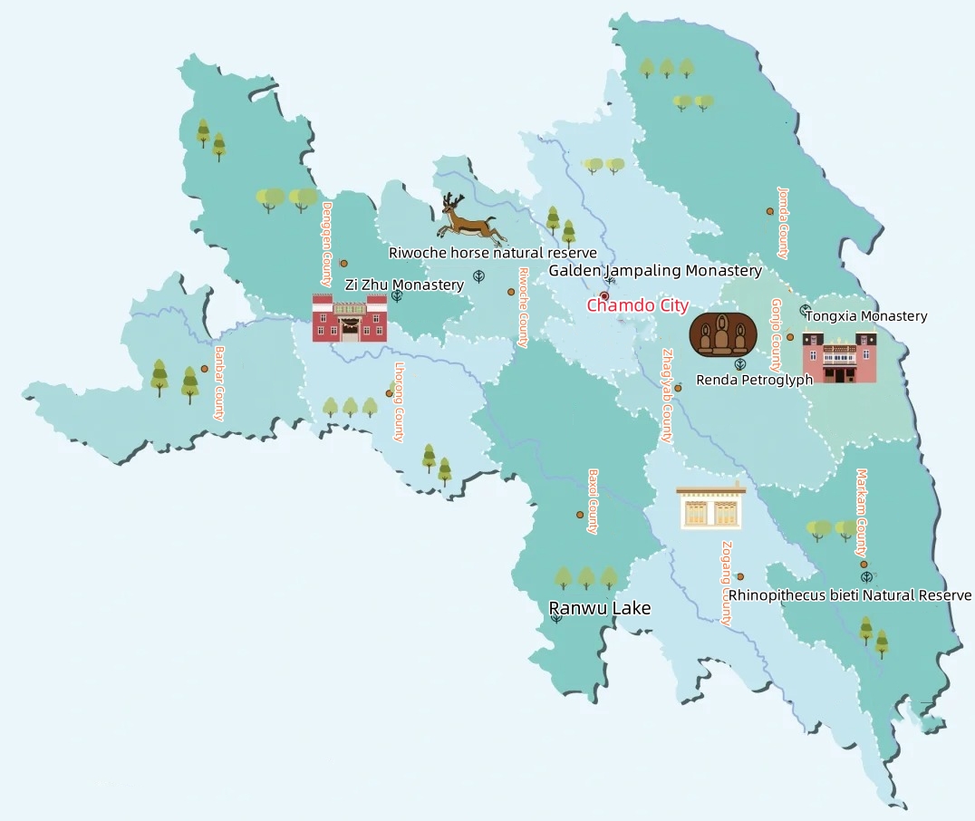
Chamdo Tourism Map
Chamdo is the eastern gate of Tibet and a region with a long history. There are famous scenic spots such as Ranwu Lake and Laigu Glacier. Here you can feel the beauty of nature and the unique charm of Tibetan culture.
