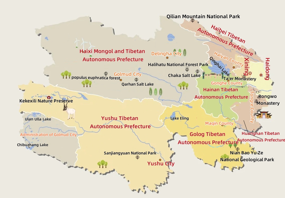
Qinghai, located in the northwest inland of China, borders Gansu Province in the north and east, Xinjiang in the northwest, Tibet in the south and southwest, and Sichuan Province in the southeast.
Qinghai covers a total area of 722,300 square kilometers and has jurisdiction over 2 prefecture-level cities and 6 autonomous prefectures; By the end of 2023, the province's resident population was 5.94 million. The native minorities in Qinghai Province mainly include Tibetan, Hui, Tu, Salar, and Mongolian, among which Tu is unique to Qinghai Province.
The terrain of Qinghai Province is generally high in the west and low in the east, high in the north and south, low in the middle, high in the west, inclined to the east, and declining in a ladder shape. The eastern region is the transition zone from the Qinghai-Tibet Plateau to the Loess Plateau, with complex terrain and diverse landforms. The average altitude of the province is over 3,000 meters. The area below 3,000 meters above sea level accounts for 15.9% of the total area of the province; The area with an altitude of 3,000 to 5,000 meters is 76.3% of the total area of the province; The area above 5000 meters above sea level accounts for 7.8% of the total area of the province.
Qinghai Tourism Map
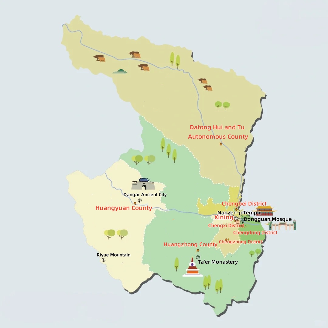
Xining Tourism Map
Xining has jurisdiction over five municipal districts (Chengdong District, Chengzhong District, Chengxi District, Chengbei District, and Huangzhong District) and 2 counties (Huangyuan County and Datong Hui and Tu Autonomous County).
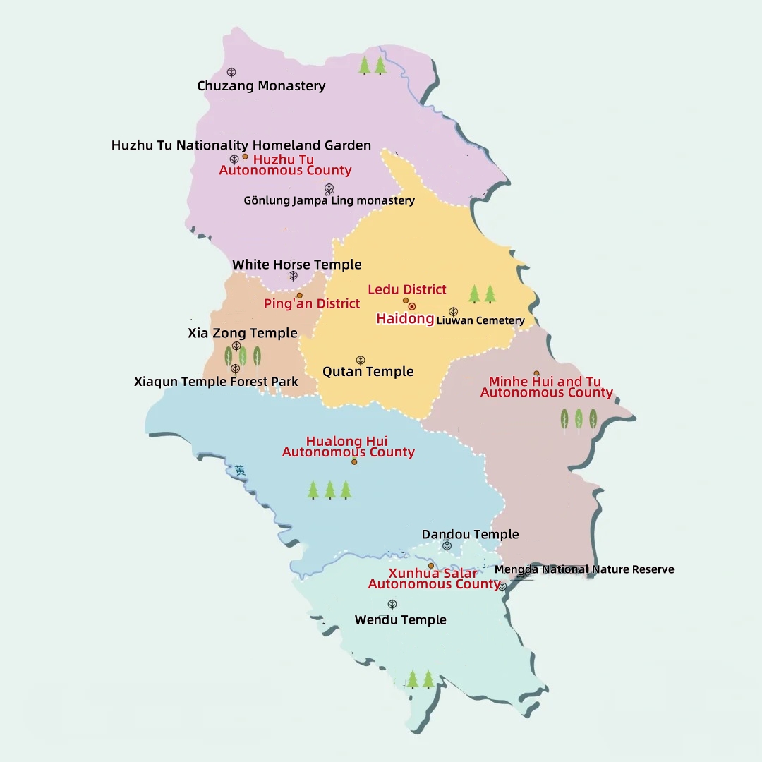
Haidong Tourism Map
Haidong has jurisdiction over two municipal districts (Ledu District and Pingan District) and four autonomous counties (Tu Autonomous County, Minhe Hui and Tu Autonomous County, Hualong Hui Autonomous County, Xunhua Salar Autonomous County).
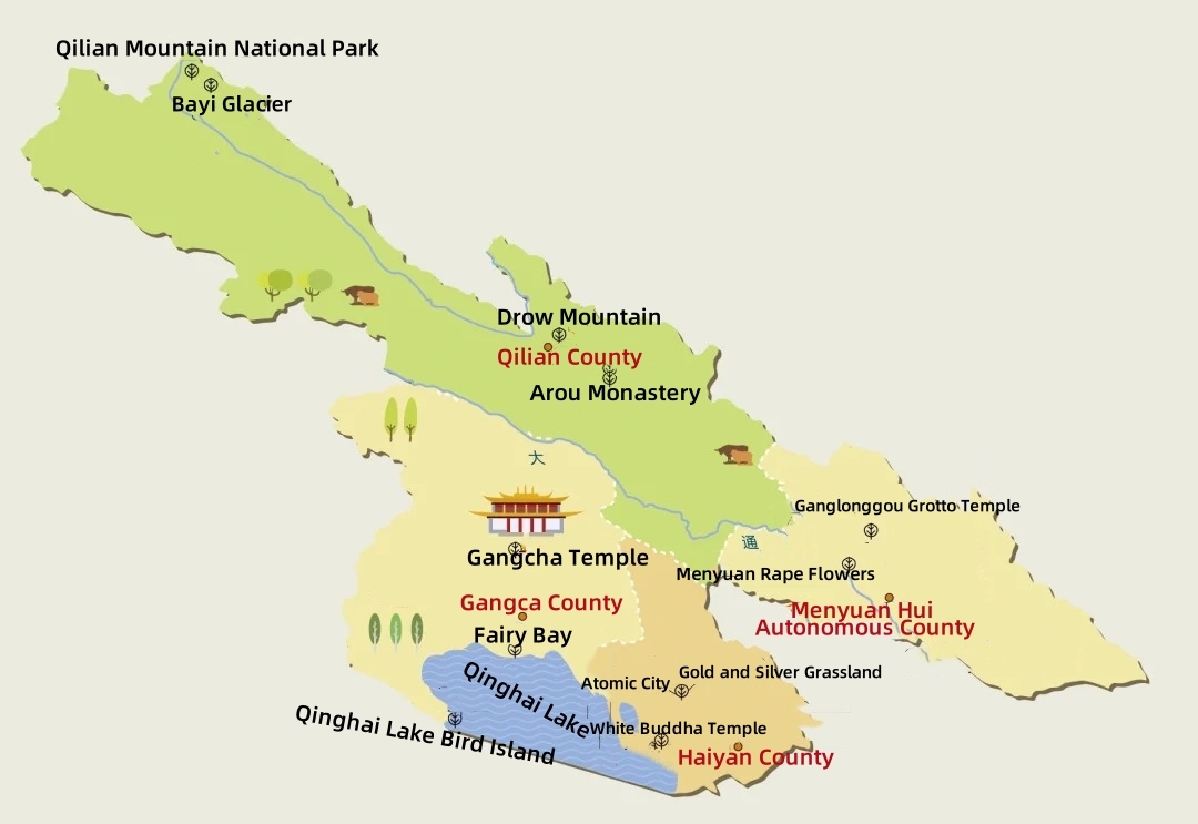
Haibei Tibetan Autonomous Prefecture Tourism Map
Haibei Tibetan Autonomous Prefecture has jurisdiction over three counties (Qilian County, Haiyan County, Gangca County) and one autonomous county (Menyuan Hui Autonomous County).
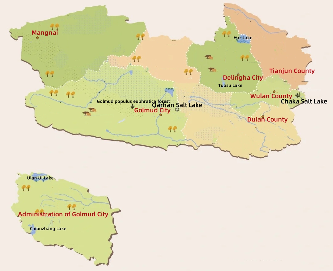
Haixi Mongol and Tibetan Autonomous Prefecture Tourism Map
Haixi Mongol and Tibetan Autonomous Prefecture has jurisdiction over three county-level cities (Delingha City, Golmud City, Mangnai), three counties (Dulan County, Ulan County, Tianjun County), and Da Qaidam (administer the autonomous prefectures directly under the town of Chaidan, Xitieshan town).
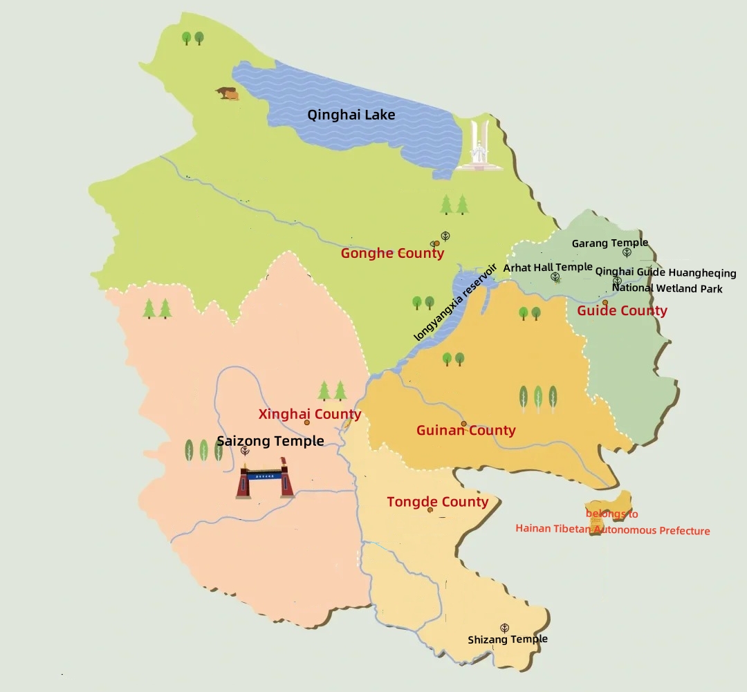
Hainan Tibetan Autonomous Prefecture Tourism Map
Hainan Tibetan Autonomous Prefecture has jurisdiction over five counties (Gonghe County, Gaide County, Tongde County, Xinghai County).
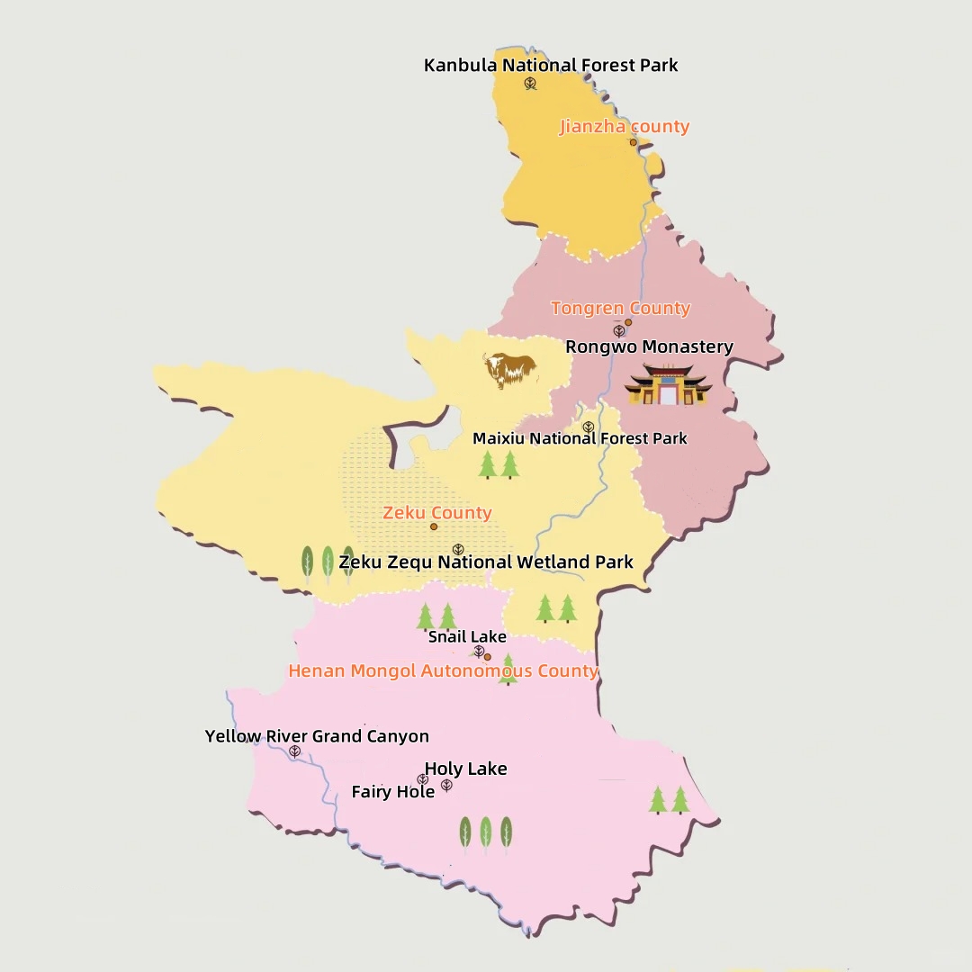
Huangnan Tibetan Autonomous Prefecture Tourism Map
Huangnan Tibetan Autonomous Prefecture has jurisdiction over one city (Tongren City) and three counties (Jainca County, Zekog County, Henan Mongol Autonomous County).
