

Silk Road Maps
The Silk Road, also called the Silk Route, was an ancient network of trade routes linking China with the West. Rather than being a single road, it consisted of many routes that passed through the steppes, mountains, and deserts of Central Asia and India, connecting China and the Far East with the Middle East and Europe.

Ancient Silk Road Route
Recommended Silk Road Tours:
10 Days Silk Road Tour: Xi'an to Urumqi
8 Days Adventure Tour to Qinghai&Gansu
14 Days Fascinating Maritime Silk Road to Xi'an Dunhuang and Xinjiang
Ancient China Silk Road Route
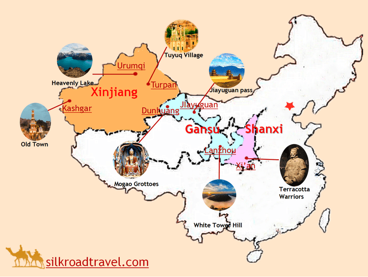
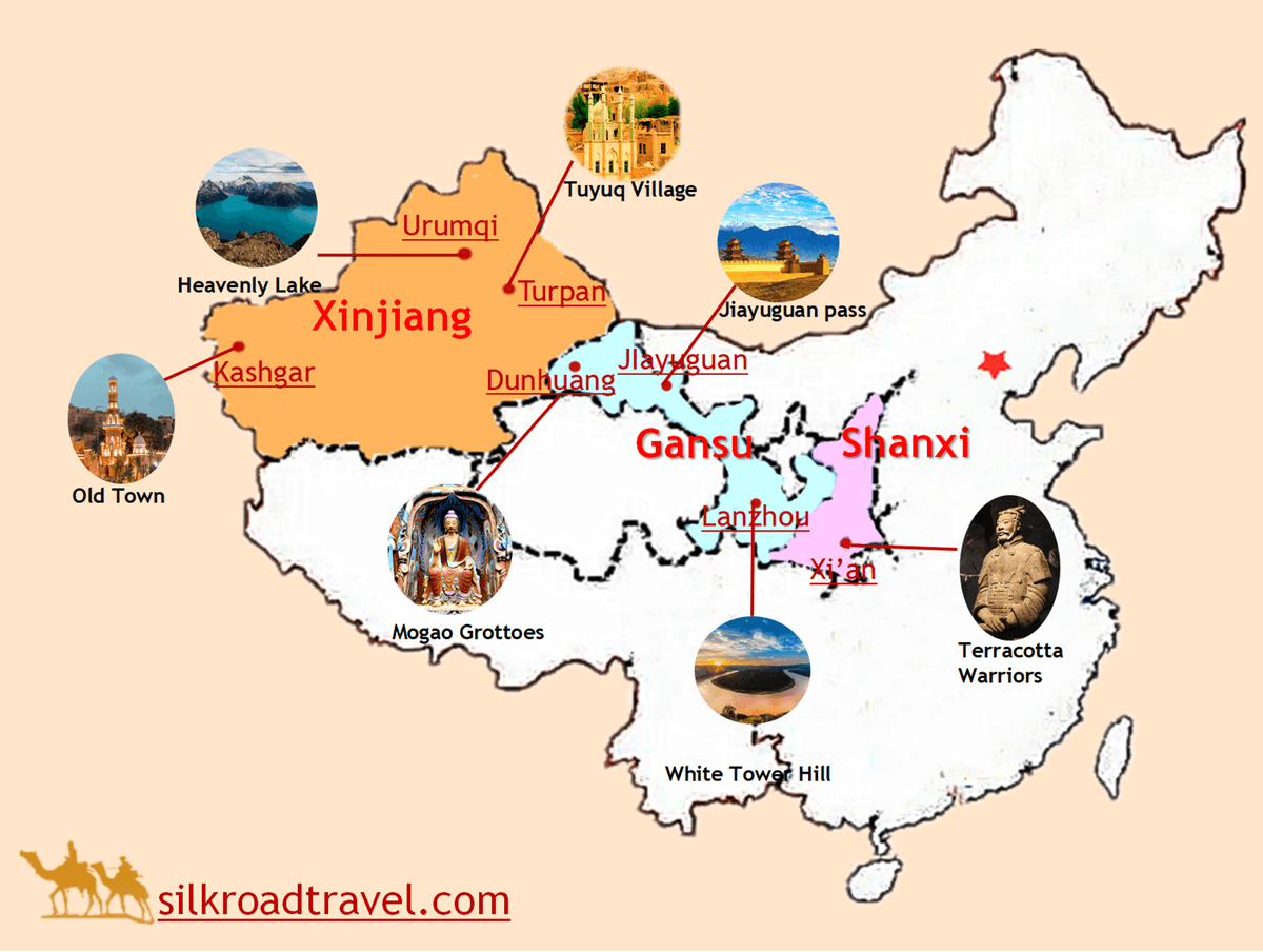
The Silk Road was originally opened up by Zhang Qian and gradually developed during the Han Dynasty (206 BC–220 AD). The ancient route originated from the historical capital of Chang'an (now Xi'an).
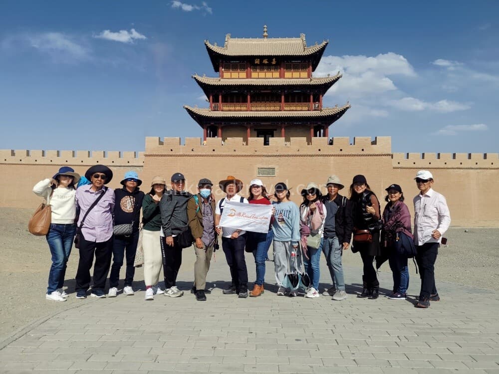
The China trade route ran through Gansu Province via Tianshui, Lanzhou, Wuwei, Zhangye, Jiuquan, Jiayuguan, an important military garrison and barrier along the Great Wall, and Dunhuang along the Hexi Corridor.
Dunhuang is famous for its Mogao Caves and other cultural relics. It was also a key point along the route, where the trade road divided into three main branches: the Southern, Central, and Northern Silk Routes. These routes then extended as far as Pakistan, India, and even Rome.
The three main routes spread across the Xinjiang Uygur Autonomous Region.

Ancient Silk Road Map
Southern Silk Route
The Southern Silk Route ran westward along the northern foot of the Kunlun Mountains, passing through Ruoqiang, Hotan, Shache (Yarkant), and reaching Kashgar, one of the final major points of the Silk Road in China.
From there, the route crossed the snow-covered Pamirs and reached Pakistan and India via Kashmir. It could also continue toward Europe through Islamabad, Kabul, Mashhad, Baghdad, and Damascus.

Central Silk Route
The Central Silk Route ran westward along the southern foot of the Tianshan Mountains, passing through Loulan (now Ruoqiang), Turpan, Korla, Kuche (Kuqa), Aksu, and Kashgar.
From Kashgar, the route crossed the high Pamirs and continued toward Mashhad via the Fergana Basin, Samarkand, and Bukhara, eventually connecting with the Southern Route.

Northern Silk Route
The Northern Silk Route ran westward along the northern foot of the Tianshan Mountains, taking merchants westward through Hami, Urumqi, and Yining. It then continued toward areas near the Black Sea, Caspian Sea, and Mediterranean Sea.

The total length of the historically important trade routes is about 10,000 kilometers, according to some experts. Today, the ancient Silk Road in China extends across five provinces and autonomous regions in Northwest China, including Shaanxi Province, Gansu Province, Qinghai Province, Ningxia Hui Autonomous Region, and Xinjiang Uygur Autonomous Region.

The Great Silk Road
The Great Silk Road was a system of caravan routes that crossed the Eurasian continent from the Mediterranean Sea to China during ancient and medieval times. It played an important role in the development of trade and cultural exchanges between the peoples and states located along the route.
This amazing journey offers a once-in-a-lifetime opportunity for those with sufficient time to travel along one of the major branches of the Silk Road, all the way across Asia from Xi'an in central China to Istanbul in western Turkey. The journey covers a distance of approximately 12,000 kilometers and passes through six contrasting countries.

Silk Road on the Sea (Maritime Silk Road)
In addition to the Silk Road in Northwest China, there were also trade routes in Southwest China and by sea, collectively known as the "Silk Road on the Sea", or the Maritime Silk Road, to distinguish them from the traditional land-based Silk Road.
The Maritime Silk Road also contributed greatly to the development of the world. Through these maritime trade routes, silk, china, tea, and brass and iron products were among the main categories exported to foreign countries, while spices, flowers and plants, and rare treasures for the imperial court were brought to China.
The two main routes followed by trading ships were the East China Sea Route and the South China Sea Route.
East China Sea Route:
The East China Sea Silk Route has a history of about 3,000 years and mainly connected China with Japan and Korea. It dates back to the Zhou Dynasty (1112 BC), when the Chinese government sent people to Korea to teach farming and sericulture. They departed from the port of Bohai Bay on the Shandong Peninsula.
When Emperor Qin Shi Huang unified China, many Chinese people fled to Korea and brought silkworms and silk-breeding technology with them. This accelerated the development of silk production in Korea. These skills and technologies were later introduced to Japan during the Han Dynasty.
Since the Tang Dynasty, silk produced in Jiangsu and Zhejiang provinces was shipped directly to Japan. Many Japanese envoys and monks also traveled to Chang'an (now Xi'an) along this sea route.
South China Sea Route:
Guangzhou was an important starting point of the South China Sea Route, which extended across the Indian Ocean and reached various countries around the Persian Gulf.
The main goods exported along this route included silk, china, and tea, while imported merchandise included various spices, flowers, and plants.
The South China Sea Silk Route was an important conduit for China's exchanges with the outside world. It was named after the South China Sea, around which much of the maritime trade route was centered.